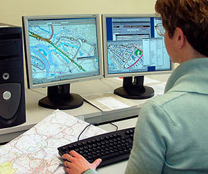
Map Maker
Tasks & duties

Map makers may do some or all of the following:
-
find out the mapping needs of the client
-
plan the layout and content of maps
-
collect and analyse data from aerial photographs and satellite images
-
study ground surveys and reports
-
create detailed drawings of the map area, often using computer-aided design (CAD) and desktop publishing software
-
oversee the production of maps
-
tender for mapping jobs
-
create computer models of land areas
-
build and update Geographic Information Systems (GIS) databases
-
check the accuracy of map information by visiting the map area
Map makers who work in aerial mapping and photogrammetry may also:
-
define the type and scale of photography required
-
take photographs from aircraft
-
check the quality of images used on maps
-
process scanned images into maps (called orthophotos)
-
process images to create 3-D modelling on the computer (known as a digital terrain model)
Specialisations
Map makers work for government and local authorities, private companies and the Defence Force. There are many specialist areas in map making such as:
Cartographer
Cartographers collect and present information about the land as digital data, paper maps and images.
Hydrographical Cartographer
Hydrographic cartographers collect and present information about the sea floor.
Aerial Surveyor
Aerial surveyors take aerial photographs and create images that are used in other disciplines of map making, but mainly by photogrammetrists.
Photogrammetrist
Photogrammetrists use information from aerial photographs and satellite images to create maps or mapping data that includes contour lines, rivers, streams, coastline, vegetation and man-made features such as roads.
Geographic Information Systems (GIS) Specialist
GIS specialists combine the information captured by photogrammetrists with existing map data, and any new information gathered. GIS technology is used in resource management, scientific investigation, environmental impact assessments and route planning. For example, it can be used to assess which properties would be affected in the event of flooding.
Skills & knowledge

Map makers need to have:
-
knowledge of the different methods, techniques and equipment used in map making
-
knowledge of different types of maps and map products
-
knowledge of the symbols used in map drawing
-
knowledge of geography and land features
-
knowledge of the New Zealand conventions for draughting and various surveying methods
-
good computer skills, including the ability to use computer-aided design (CAD) and Geographic Information Systems (GIS) software, imaging programs and photographic enhancement products
-
skill in analysing and interpreting information
-
design and artistic skills
-
analytical and problem-solving skills
-
writing and communication skills
-
maths skills
Entry requirements
There are no specific entry requirements to become a map maker, although most employers prefer you to have a Bachelor of Science majoring in computing, geography, or Geographic Information Systems (GIS).
Secondary education
A tertiary entrance qualification is required to enter university. Useful subjects include geography, geology, graphics, computing, English and maths with statistics and/or calculus.
Tertiary education
Most New Zealand universities offer Bachelor of Science programmes where you can major in computing or geography, and take papers in GIS, cartography, photogrammetry, spatial analysis and resource management, which are recommended for map makers.
The University of Otago is the only university that offers a four-year Bachelor of Applied Science in Geographic Information Systems (GIS).
Training on the job
Map makers learn many skills on the job. Some senior map makers attend training courses and seminars overseas, as there are few relevant courses in New Zealand, particularly for cartography.
Useful experience
Useful experience for map makers includes:
-
work in draughting, graphic art, geography or surveying
-
using computers for database analysis, design or drawing
-
involvement in outdoor activities such as tramping and orienteering
Related courses
Graphic Arts and Design Studies
Mapping Science
Surveying
For more information, please refer to Career Services.
Document Actions
